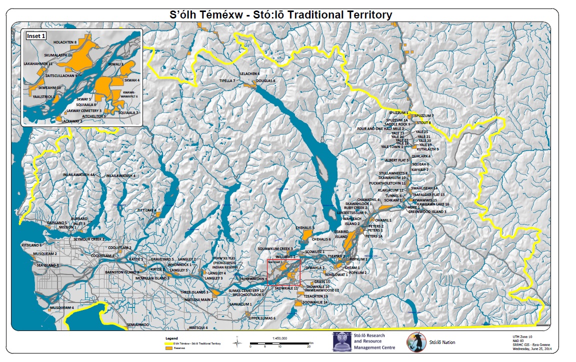
GIS - Geographic Information Systems
The Stó:lō Research and Resource Management Centre includes a well equipped Geographic Information Systems Unit. The Unit maintains an ArcGIS Enterprise Server (10.6.1) that hosts geospatial data layers including the Stó:lō Heritage Database (SHeD) for use by members of the GIS Unit, as well as other GIS users in the Department.
The GIS Unit uses ArcMap, ArcPro, an ESRI Webserver, and supports three custom web portals – one portal for referral processing by PRRO staff and Stó:lō resource managers, one portal for land review, and cultural data storage and analyses with streaming of DataBC spatial information, and a third for tracking permitting and consultation resulting from the TransMountain Pipeline Expansion Project and other Major Projects. The Unit currently has three members, an Analyst/Manager, a GIS Specialist, and a GIS Technician. They also provide support for seven other GIS users in the Department, a Manager/Analyst in the People of the River Referrals Office group, and 6 Archaeologists.
Our GIS program has linked scientific and community based knowledge in projects including cultural use studies, archaeology potential modeling, place names, cultural inventories and cultural use management planning.
Services provided by the GIS Unit include:
• Interview mapping of cultural use areas and cultural knowledge
• Physical development and land use plans
• Spatial analysis
• 3-D landscape modeling of cultural sites
• Digitization/data capture for referrals, cultural, and land review through the web portals,
• Map books, on-line maps, and map graphics
• Web map hosting and development
For more information contact: colin.green@stolonation.bc.ca
or call SRRMC at 604-824-2420 or toll free 1-800-565-6004